The Point Panel
The Point panel has options for controlling the Point's properties.
The following properties are on the Point panel:
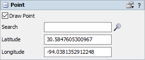
Draw Point
If Draw Point is checked, then a 3D point will be drawn at the point's geographic location on a map. The point can still be selected in the 3D view whether the 3D point is drawn or not.
Search
Query the geocoding server for a location by name or address and set the point's latitude and longitude based on the result.
Latitude
This number defines the latitude of the point.
Longitude
This number defines the longitude of the point.